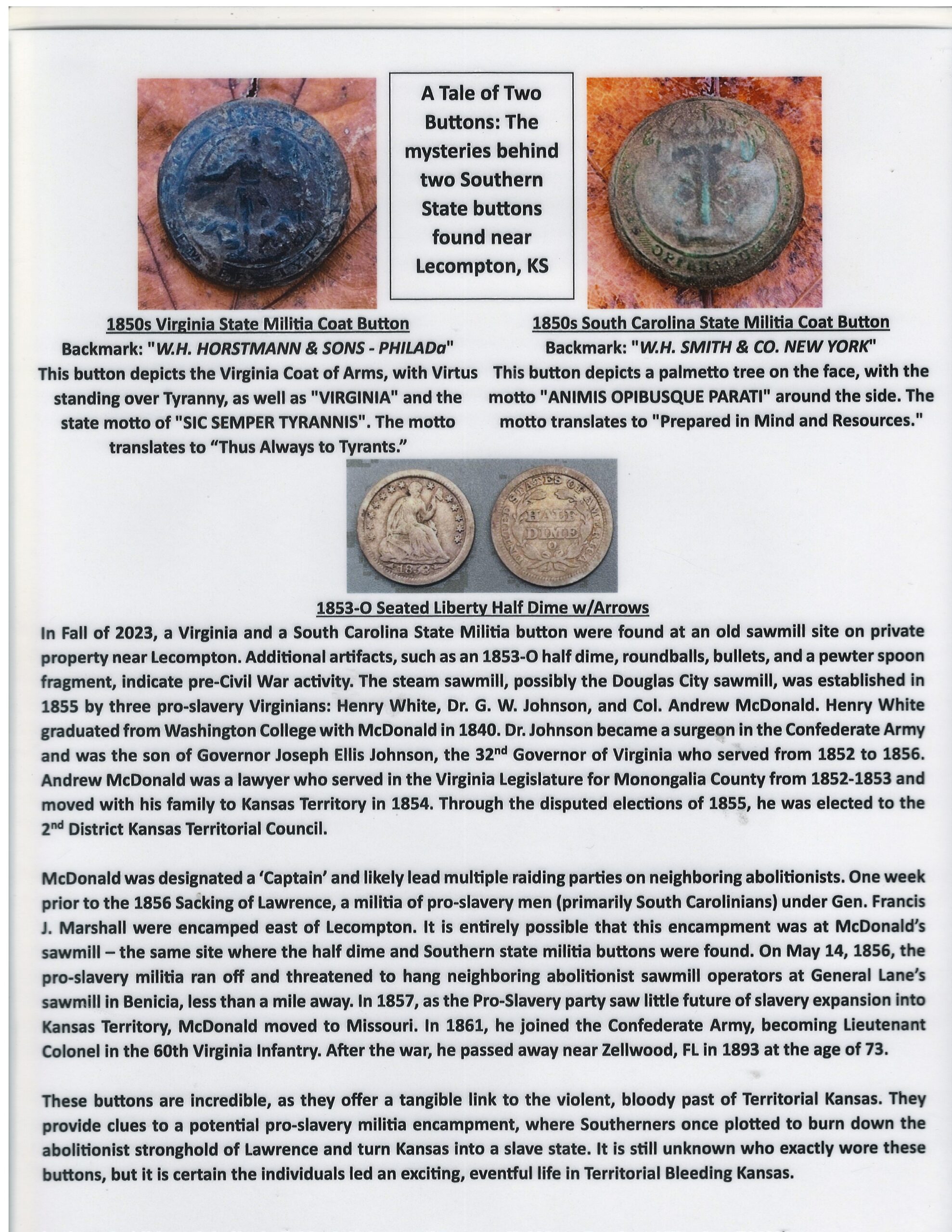
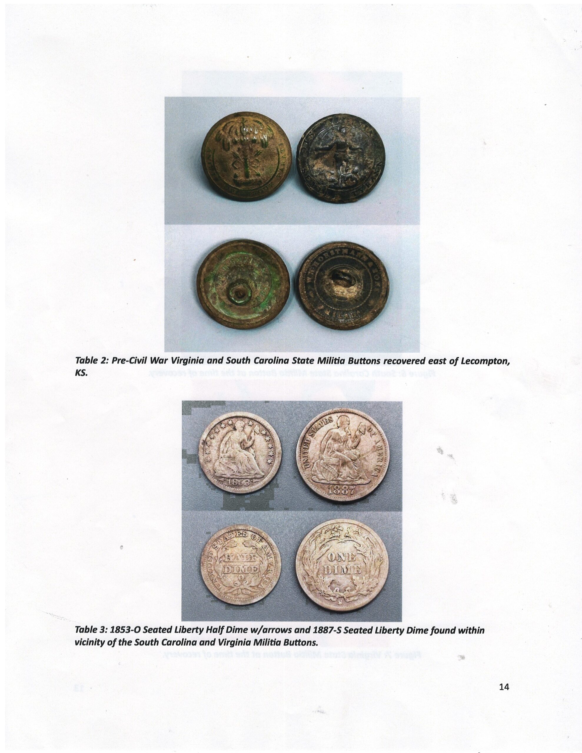
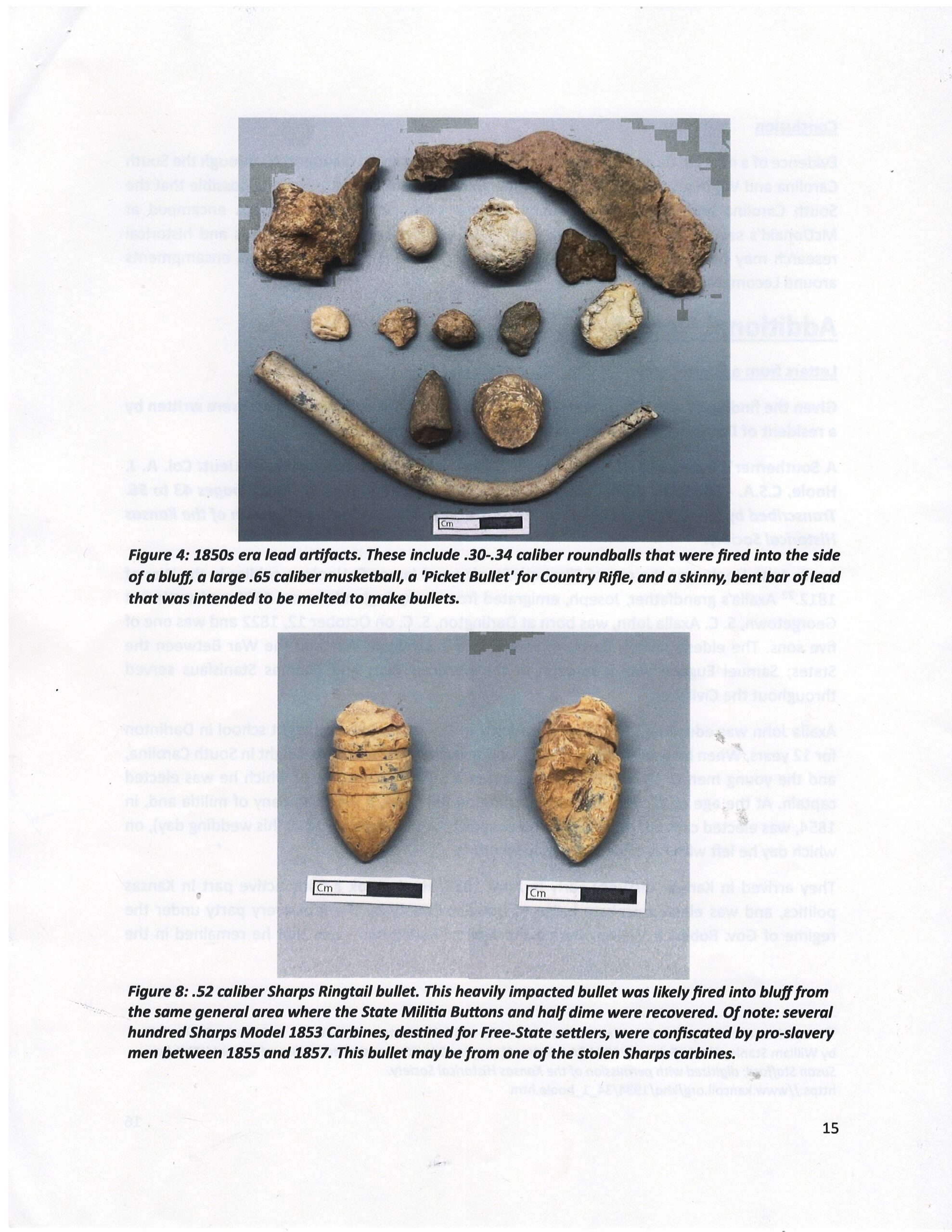
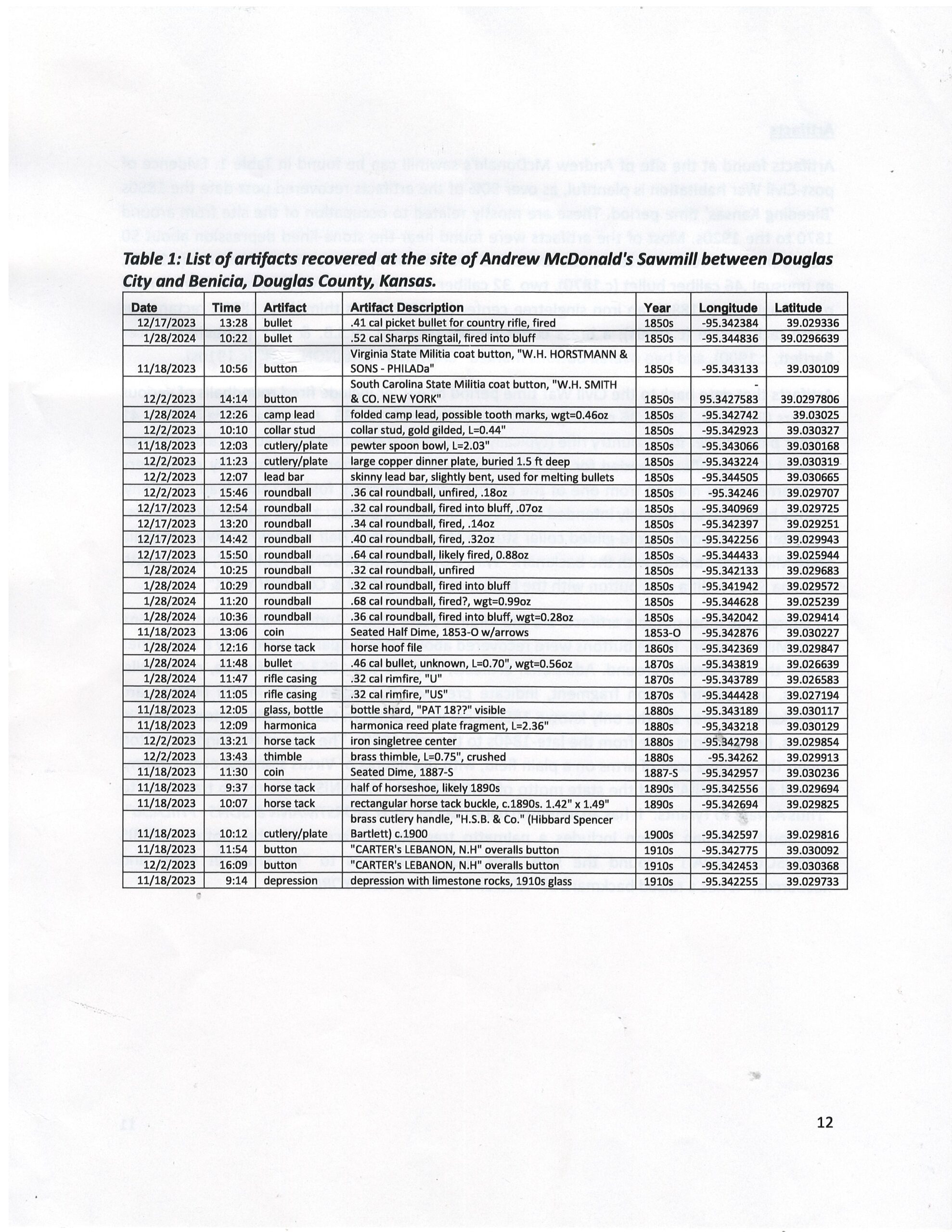
Between 1854 and 1857, the Lecompton area was a hive of activity as pro-slavery Southerners arrived with the goal of expanding slavery to the new Kansas Territory. While many Southerners came to establish homes, others had little intent on settling in the territory for the long term. They instead arrived as militia groups, intent on running out nearby abolitionists in and around neighboring towns such as Lawrence. During the Fall of 2023, a brief metal detecting survey was conducted by Andrew M. Peterson, at the site of a sawmill and pro-slavery militia encampment two miles east of Lecompton. There, on the south side of the Kansas River an intermittent unnamed creek flows through a narrow, heavily wooded valley, bounded by limestone cliffs before it enters the Kansas River. On the east bank of the creek is a small depression lined by buried limestone rocks. Another depression is located at the base of the east cliff. As the topography drops rapidly towards the Kansas River, deep swales, signs of heavy wagon traffic, are visible on the east side of the creek. At the point where the swales disappear into the level ground of the valley floor, artifacts were recovered that help tell the story behind Bleeding Kansas, and to a larger extent, the events and conflicts in Kansas Territory that lead to the Civil War.


